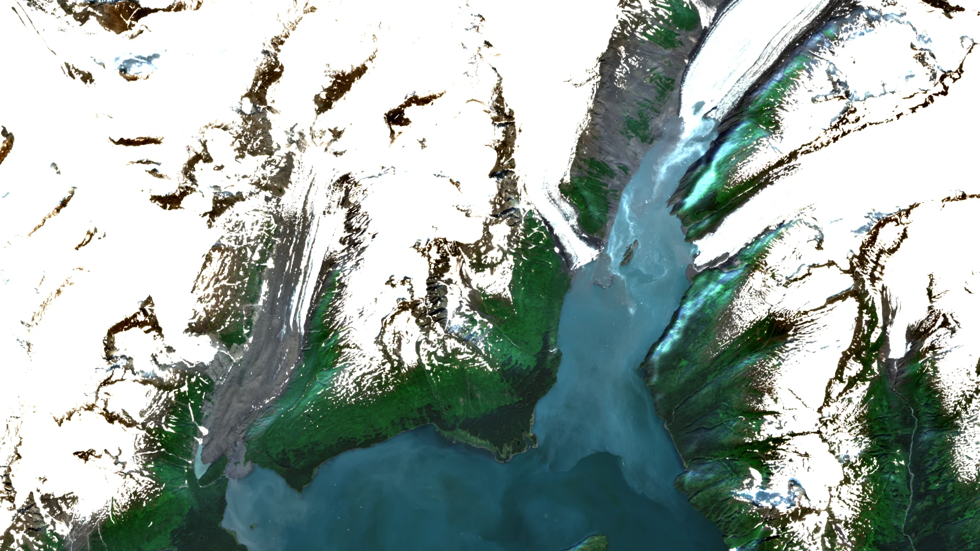

Satellite view of Barry Arm, Alaska: glacier ice and snow-covered ridges flank a narrow fjord.

Stony Brook University

Qianyi Liu

PhD Student in Civil Engineering

Geohazards, geospatial AI, remote sensing, and machine learning

View papers
Barry Arm, Alaska61.116° N  148.208° W
Copernicus Sentinel-2 · 19 Jul 2024

About me

Portrait of Qianyi Liu

I use terrain and satellite data to study where landslides and floods are likely to occur.

My colleagues and I used simulations of 78 tropical cyclones to map flood susceptibility in the Pearl River Delta. In my current landslide research, I ask whether a model trained in one region can identify susceptible slopes in another, where records are sparse.

Selected publications

Geoscience Frontiers · 2026

Integrating Explainable Ensemble Machine Learning with Hydrodynamic Modeling to Assess Tropical Cyclone-Induced Flood Susceptibility

Qianyi Liu, Liang Gao, Haoxuan Du, Te Pei, Sin-Chi Kuok, and Si Chen

We used flood simulations from 78 tropical cyclones to train an ensemble model and mapped where flooding is more likely across the Pearl River Delta.
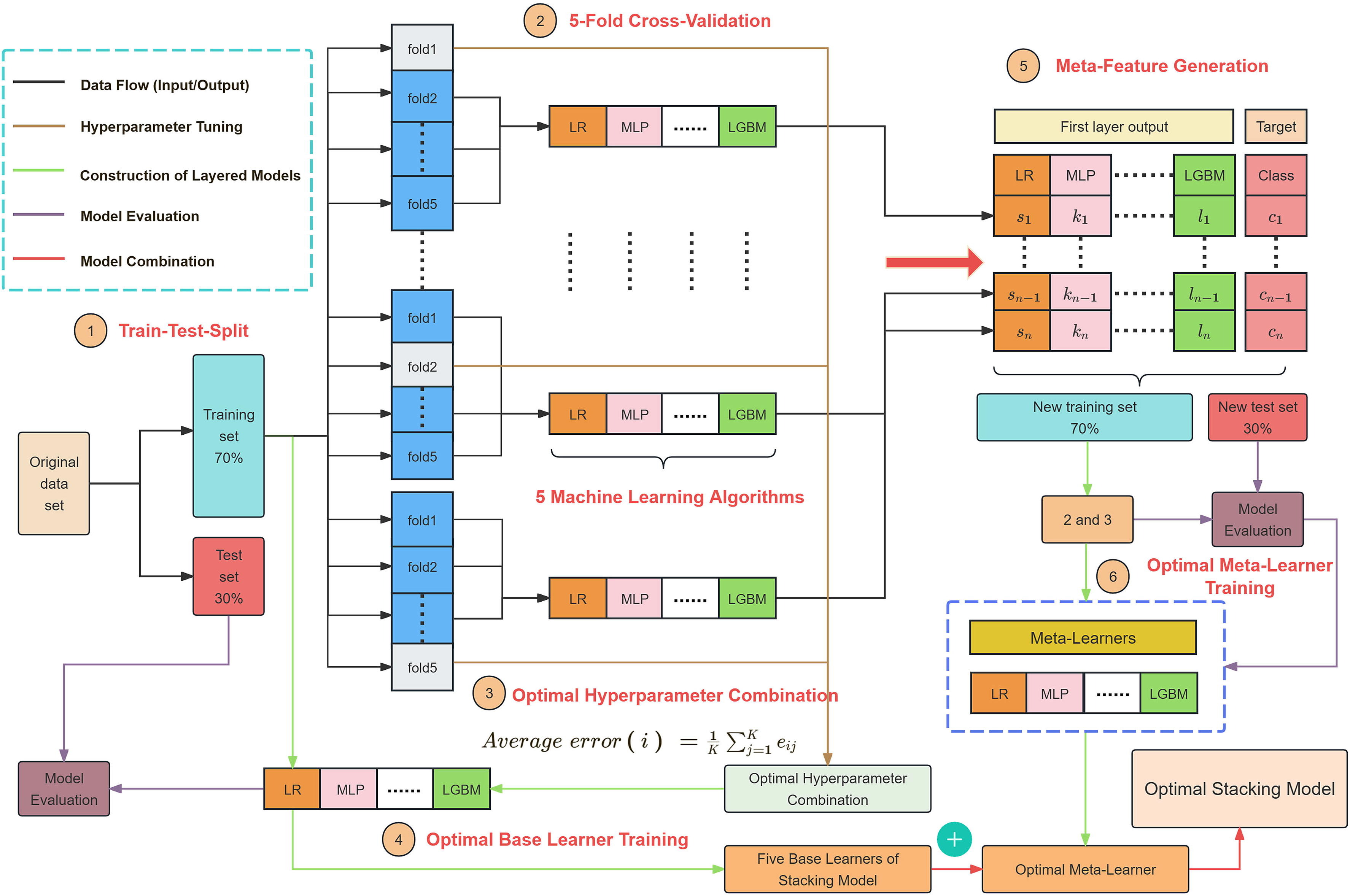
Flowchart from a 70/30 train-test split through five-fold cross-validation, base-learner training, meta-features, and final evaluation. Model workflow Open original

Five base learners supply predictions to a second model. The diagram traces the training and evaluation steps.
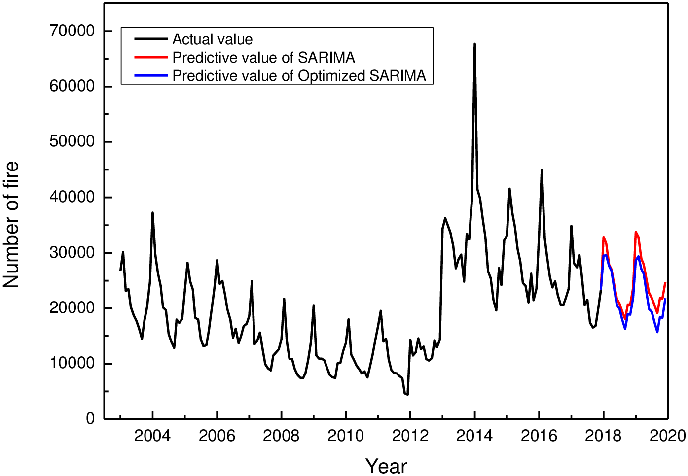
Figure source Liu et al., Geoscience Frontiers (2026). CC BY-NC-ND 4.0

PLOS ONE · 2021

A prediction method of fire frequency: Based on the optimization of SARIMA model

Shuqi Ma, Qianyi Liu, and Yudong Zhang

After two outlying months were adjusted, the SARIMA model predicted annual fire totals closer to China's reported counts in both 2018 and 2019.

Historical monthly fire counts are plotted in black through 2017. Both forecasts show seasonal peaks in 2018 and 2019, but the optimized model (blue) predicts fewer fires than the original model (red). Fig. 8 Open original

Monthly fire counts in China and forecasts from the original and optimized SARIMA models for 2018 and 2019.

Figure source © 2021 Ma, Liu & Zhang, PLOS ONE. CC BY 4.0
Manuscripts under review (2)

Submitted to Bulletin of Engineering Geology and the Environment · 2026

Spatially Robust Explainable Machine Learning for Landslide Susceptibility Mapping: Interpreting Spatially Heterogeneous Controls

Qianyi Liu, Xiaolu Liu, Hongzhi Cui, Yingli Tian, Naresh Devineni, and Te Pei

Submitted to Ocean Engineering · 2026

Tropical Cyclone-Induced Compound Flooding Reveals Critical Flood Zone Transitions in the Pearl River Delta

Haoxuan Du, Ke Fei, Qianyi Liu, and Li Zhang

Publication figure

Research directions

Projects

Published

Explainable Machine Learning for Tropical Cyclone-Induced Flood Susceptibility

This project integrates hydrodynamic modeling, remote sensing-derived predictors, and ensemble machine learning to assess tropical cyclone-induced flood susceptibility. It uses interpretable machine learning methods to identify key flood-driving factors and produce spatially explicit susceptibility maps.

Methods and outputs

Methods · Hydrodynamic modeling, ensemble machine learning, SHAP, GAM, remote sensing, GIS, Python.

Outputs · Flood susceptibility map, SHAP summary plot, model workflow diagram.

Read the paper

Under review

Spatially Robust Landslide Susceptibility Mapping

This project develops spatially robust landslide susceptibility models using landslide inventories, terrain and environmental conditioning factors, PU learning-based negative sampling, spatial cross-validation, and model interpretation methods.

Methods and outputs

Methods · Landslide inventory analysis, PU learning, CatBoost, spatial cross-validation, SHAP, causal analysis, GIS.

Outputs · Landslide susceptibility map, spatial cluster map, feature importance and interpretation plots.

Ongoing / Under preparation

Self-Supervised Learning for Small-Sample Landslide Susceptibility Mapping

This project investigates whether self-supervised representation learning can improve small-sample landslide susceptibility mapping. It uses dual-view geospatial patches, ResNet-style CNNs, masked reconstruction, contrastive learning, and few-shot fine-tuning for spatial transfer evaluation.

Methods and outputs

Methods · PyTorch, ResNet-18, dual-view patches, masked reconstruction, contrastive learning, fine-tuning, few-shot learning.

Outputs · SSL workflow diagram, model architecture figure, cross-validation performance comparison.

Teaching

CIV330 / CIV341

Teaching Assistant, Stony Brook University.

CIV364 / CIV420

Teaching Assistant, Stony Brook University.

Curriculum vitae

PhD Student in Civil Engineering
Department of Civil Engineering, Stony Brook University

Download CV (PDF)
Technical skills

Python, MATLAB, R, SQL · ArcGIS Pro, ArcMap, Google Earth Engine, QGIS · scikit-learn, PyTorch, XGBoost, LightGBM, CatBoost.

Research Q&A

Suggested questions